Posts Tagged research
Urban Analysis Marseille France
‘Paul Virilio metaphorically predicted a future in which communication and transport networks would bring about the disappearance of public space. People in the network city would no longer be able to identify with a geographical location and would be doomed to a nomadic existence.’
OASE 53, Network Urbanism
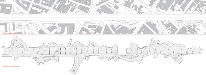
The contemporary city is involved in processes of globalization; they are the scenes of current technological, economical and cultural transformations. Areas are transformed into themed areas and different social groups are separated. I am interested in this border condition between the global and the local. The area of the urban analysis in Marseille is situated under and next to the highway [A7]. The highway divides the residential areas St-Mauront and La Joliette and has no function for the residents. Houses are demolished for the construction of the highway and the residential neighborhood is totally neglected. The area has not become a ‘non-place’; it has great qualities for the residents. People are using this area in many different ways, it has become a lively place with interaction between different social groups. The area can be seen as Le Corbusier’s ‘Plan Obus’; integration of different cultures, architectural styles and life-styles are granted, by the coexistence in the same huge infrastructure. Future plans are to demolish a part of the highway and to make a boulevard with commercial buildings. The area would physically and socially be divided and the quality of the area is lost.
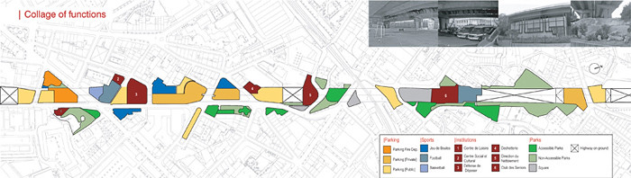
| Collage of functions
The area under and next to the highway is characterized by a collage of functions. Functions which have no relation with each other are situated next to each other. The whole area is filed with functions; while it is to be expected people would turn away from the highway. Apparently the area has ‘hidden’ qualities.
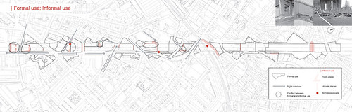
| Formal use; Informal use
Although the entire area is filled with formal functions, people are using the area in a different way. This informal use can exist in this area because it is not important for the local government in a cultural and economical way. For example; homeless people are banned out of the city center, to maintain the good reputation of the city. This area is not attractive for tourists and businessmen and therefore homeless people can live here. Places where Informal use is taking place are characterized by the lack of sight lines, they are ‘hidden’ places which can easily be overlooked when walking trough this area. In the area are also places where the informal use has taken over the formal use, for example; a parking places that look more like a dump yard then a parking place.
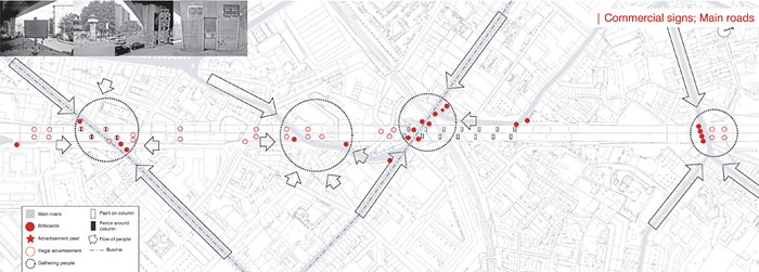
| Commercial signs; Main roads
The commercial signs are gathered along side the main roads in the area, where most people pass by. There is a lot of illegal advertisement in the area, but is only actively banned from areas next to main roads. At those places are rough texture paint and fences around columns preventing illegal advertisement. In contrast with paint, the fences are not very effective; illegal advertisement is stitched to the column above the fence.
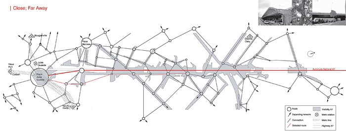
| Close; Far Away
The highway is clearly present in the neighborhood To access the highway, a detour must be taken. The highway is visual close, but physical far away.
| Two different worlds…
The areas on and under the highway A7 are two different worlds, not only different social groups [highway; tourists and businessmen, area under highway; local residents], but also in experience. The experience of driving on the highway is totally different from the experience of the area under the highway. The view on the highway is dominated by the Notre Dame de la Garde. The experience of the area under the highway is more fragmented, a lot of places with different atmospheres can be found here next to each other.

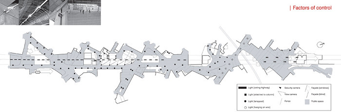
| Factors of control
There are a lot of factors [facades, fences, lights, cameras] present in the area that determine the control of it. Fences are situated around all functions [public and private]. They function in a different way; as a visual border between two areas, to exclude people from privatized areas or for safety reasons [football and basketball court]. There are many blind facades in the area, partly because of demolished parts of housing blocks for construction of the highway. Areas from where no windows can be seen, gives the particular area an unsafe feeling. The lampposts are not sufficient to light the area at night, because of the many obstacles [fences, height differences, walls, trees, etc.]. Some privatized areas and public functions like squares have good lightning, but in most areas it is unpleasant to walk at night.
|Heightmap
The differences in height are important for the experience of the area. The height varies between 2.5 and 20 meters and this is only the case under the highway. Some places provide a magnificent view over the area, others are extremely introverted.

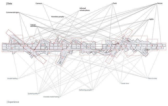
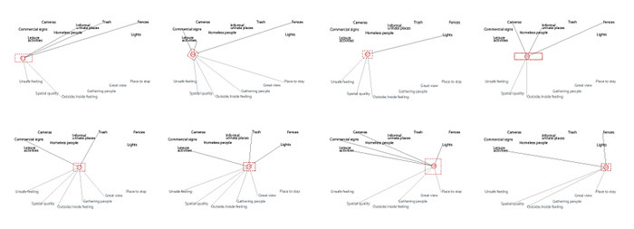
| Data and Experience map
The area is divided in 20 places which can be seen as rooms in the building, each place has its own atmosphere. By combining my experiences in the area and the collected data, relations become visible. Several places have the potential to become lively places, but are now dominated by a negative experience. The preconditions are already present to make it a valuable place for the local community. The future plans to demolish a part of the highway and to make a boulevard with commercial buildings, would physically and socially divide the neighborhood and is therefore not valuable for the local community.